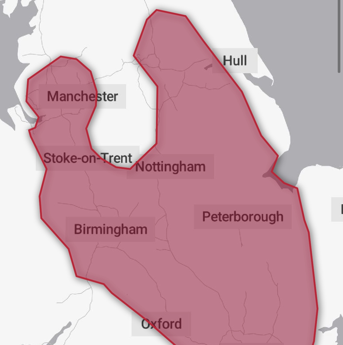
The Met Office has issued a ‘Red Heatwave’ warning for parts of England.
Herefordshire currently remains under an amber heatwave warning.
Exceptional, perhaps record-breaking, temperatures are likely on Monday, then again on Tuesday. Nights are also likely to be exceptionally warm for the UK, especially in urban areas. This is likely to lead to widespread impacts on people and infrastructure. Temperatures are expected to drop away from Wednesday onwards.
An exceptional hot spell on Monday and Tuesday leading to widespread impacts on people and infrastructure.
What to expect
- Population-wide adverse health effects experienced, not limited to those most vulnerable to extreme heat, leading to serious illness or danger to life. Government advice is that 999 services should be used in emergencies only; seek advice from 111 if you need non-emergency health advice.
- Substantial changes in working practices and daily routines will be required
- High risk of failure of heat-sensitive systems and equipment, potentially leading to localised loss of power and other essential services, such as water or mobile phone services
- Significantly more people visiting coastal areas, lakes and rivers, leading to an increased risk of water safety incidents
- Delays on roads and road closures, along with delays and cancellations to rail and air travel, with significant welfare issues for those who experience even moderate delays
More Details – https://www.metoffice.gov.uk/weather/warnings-and-advice/uk-warnings#?date=2022-07-18&id=b01e382c-77dc-4ac0-9ba4-d81c80dd1690