Herefordshire has been hit by torrential downpours which have caused significant issues with flooding across wide areas of the county, with the Met Office warning that more could be on the way this weekend.
The worst affected areas have been Hereford, Ledbury and Ross-on-Wye where a number of businesses and properties have been flooded.
In Ross-on-Wye Brookend Street was once against closed due to flash flooding. Morrisons was also forced to closed for the remainder of the day due to large quantities of water leaking through the ceiling of the store.
In Ledbury, roads became rivers quickly, with almost two inches of rain falling in just one hour.
Hereford saw a three hour thunderstorm cause chaos, with areas such as Kingsway, Kempton Avenue, Three Elms Road, Kings Acre Road, Grandstand Road and Holmer Road all seeing significant issues with standing water and flooding.
Hereford & Worcester Fire and Rescue Service were called to help pump water out of properties in the Whitestone area, with some roads near Withington under several inches of water.
The A4103 (Hereford to Worcester Road) is closed at Withington due to flooding.
A number of businesses have confirmed that they will be closed on Saturday morning, including Holmer Park and Hereford Leisure Centre.
A spokesperson for Hereford Leisure Centre said:
“The centre will be closed Saturday 21st from 7-9am.
“We are trying to phone round everyone who has booked an activity during this time, if you know someone who has and can help pass on the message we would really appreciate it.
“We will update you in the morning on the situation for the rest of day.“
A spokesperson for Holmer Park said:
“Unfortunately due to the weather and subsequent flooding we have had to close Holmer Park this evening to ensure the safety of our members and our staff team.
“We will assess the situation tomorrow (Saturday) and make a decision on opening then.
“Therefore we will definitely not be open at our usual time on Saturday morning.
“Please check our website www.holmerpark.co.uk before travelling to us as we will update there first when we have any news.
“Thank you for your understanding.”
Weather Warning – Saturday:
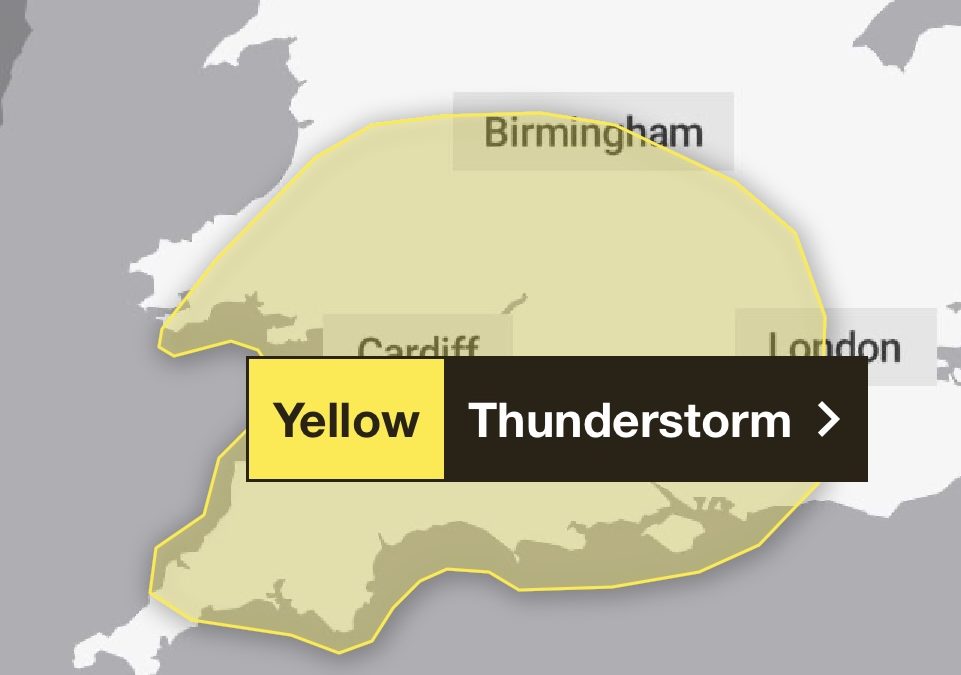
“Whilst there is some uncertainty in the details, scattered showers and thunderstorms are likely to develop and spread northwestwards at times later on Friday night and through Saturday.
“While much of the time it will be dry, and not all places will see these, where they do occur 20-40 mm could fall in less than an hour, with a small chance of isolated accumulations of 50-70 mm over the course of a few hours.
“In addition, hail and frequent lightning may accompany the most intense storms, especially during Saturday afternoon and evening in parts of the Midlands, southern England and east Wales.”
Warning Link – https://www.metoffice.gov.uk/weather/warnings-and-advice/uk-warnings#?id=05b32969-5f58-4ffa-9dc5-b44778bd80b8&date=2024-09-21
Weather Warning – Sunday:
Parts of Herefordshire could see a months worth of rainfall in ‘just 12-24 hours’ on Sunday, with torrential downpours likely.
With Met Office warnings in place for today (Friday), as well as Saturday, it’s expected to be a wet few days in some parts.
The risk on Sunday is of a more organised area of torrential rain moving across Herefordshire, as well as other parts of England and Wales.
The Met Office warning for Herefordshire on Sunday says:
“Showers and thunderstorms are expected to merge into broader areas of heavy rain across parts of Wales, central and southern England during Sunday.
“Whilst the strongest signal for impactful rainfall totals appears to be centred across east Wales and west-central England, there is potential right across this highlighted region for some areas to see 30-50 mm in less than 6 hours, with a few places receiving 60-80mm over the course of 12-24 hours.
“Southwest England looks likely to see some heavy rain during the early hours of Sunday morning, breaking up into slow-moving, heavy and in places thundery downpours during the day time.
“Meanwhile, the areas of heavy rain are likely to continue pushing north and west, becoming slow moving across some northern and possibly eastern reaches of the warning area during the rest of Sunday.”
Warning Link – https://www.metoffice.gov.uk/weather/warnings-and-advice/uk-warnings#?id=578244a7-7027-4c50-a1a1-5924a3dad828&date=2024-09-22


