
The Met Office has updated its weather warning for snow today, with up to 30cms of snow possible over the highest ground in Wales.
Rain is likely to turn to sleet or snow in Herefordshire later today, but any accumulations are likely to be small away from high ground.
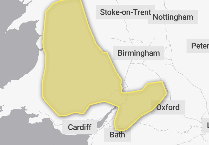
From Met Office:
Update to extend the warning further north across Wales and to move it slightly further north across South Wales. Some slight changes to the further details section as well as highest accumulations now more likely further north across Wales.
An area of rain across Wales and southern England will edge further north into the Midlands and become slow moving for a time. Rain is expected to become heavy and then turn to sleet and then snow later this morning, before easing this afternoon and clearing south. A few cm of snow are possible at low levels, but more persistent snow is expected across mid and north Wales and some hills elsewhere, with 3-7 cm of snow possible above 150 m elevation and 10-15 cm over higher ground (above 250 m), mainly in Wales. There is also a low chance of around 20-30 cm over parts of the higher routes in mid and north Wales (e.g. Clwydian Range).


