
There is a risk of significant flooding in parts of Mid/North Wales and Herefordshire this coming week, as an active area of low pressure heads across the United Kingdom.
The Environment Agency has warned that heavy rain across Mid Wales could see river levels on rivers such as the Wye and Severn rise significantly towards the middle of the week.
The Five Day Flood Risk Forecast from the Environment Agency says:
Local river and surface water flooding is probable across parts of the north of England during Tuesday, Wednesday and Thursday, and possible more widely across Wales and parts of central, eastern and northern England on Tuesday, Wednesday and Thursday. Properties could flood and there could be travel disruption. Local river and surface water flooding is also possible elsewhere across parts of central and southern England on Wednesday and Thursday. Land, roads and some properties could flood and there could be travel disruption.
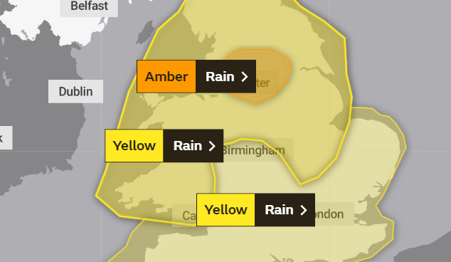
The Met Office has also issued weather warnings for heavy rain:
Several days of persistent and occasional heavy rain are expected to affect the region. The heaviest and most persistent rain is likely to be across Wales and the high ground of northern England (Pennines). By early Thursday, 30-60 mm of rain is expected to fall widely across the warning area, with 100-150 mm over the high ground of Wales and northern England. Up to 200 mm is possible across parts of north Wales. Melting snow across higher parts of the Pennines may exacerbate the potential for flooding. Strong winds will also accompany the rainfall and may add to travelling difficulties across areas higher and more exposed routes.
© OpenStreetMap contributors // OpenStreetMap


