
Plans for a large solar farm on the outskirts of Hereford have been given approval by Herefordshire Council.
The plans, for the site in the Westhide area of Herefordshire, were approved on Wednesday.
The application was submitted on the 20th December 2021 and was seeking permission for a solar generating facility on land to the North West of the small settlement of Westhide.
Throughout the application process the proposal has been amended to respond to comments and representations received during consultations.
On its original submission the scheme presented would have had a generating capacity of 34.6 megawatts (MW).
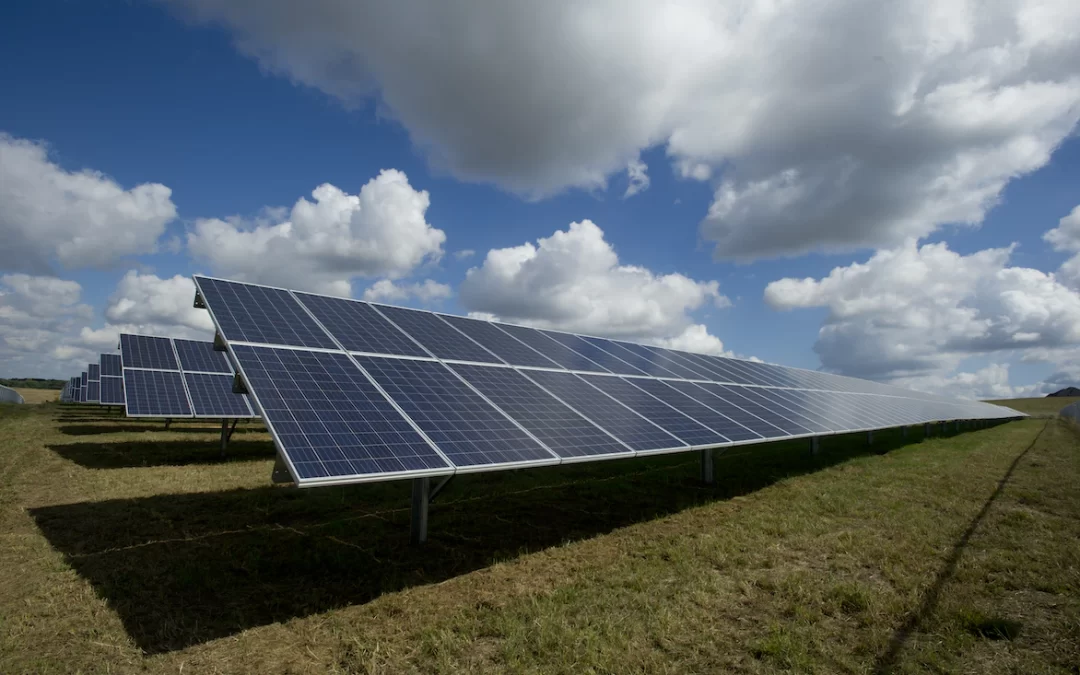
However, the proposal now for consideration is a solar development generating facility with a capacity of 25.1 MW from 45,684 individual solar panels.
Westhide is a small rural parish located between the Hereford to Worcester Road (A4103) and the Bromyard Road (A465), 6 miles northeast of Hereford.
The village of Withington is located approximately 2 miles north-east of Westhide and the small village of Ocle-Pychard (Burley Gate) to the north.
The Church of St Bartholomew is in the centre of the parish with residential properties clustered around it.
The Wellington Neighbourhood Development plan identifies 33 existing dwellings within the parish. The route of the former Herefordshire and Gloucestershire canal forms the northern boundary of the parish, with the elevated Westhide Wood and Shucknall Hill forming the southern boundary.
The proposal consists of a solar generating facility with a capacity of 25.1 MW comprising 45,684 individual solar panels (arranged in several arrays) and associated infrastructure including security fencing, CCTV cameras, and internal access track, underground cabling, inverters, substation and environmental enhancement measures.
The electricity to be generated form the solar photovoltaic arrays will be fed directly into the National Grid via the Hereford substation at Dormington.
The solar scheme would generate around 26,385MWh of electricity every year which equates to the amount of electricity used by 9,098 typical, medium – usage households.
The baseline route of cabling for the connection falls outside of the planning process, however the applicant has confirmed that the route avoid the local road networks and villages and will consist of underground trenches and connections to existing electricity poles.
The solar panels will be mounted in rows across the site in an east – west orientation to face south at 10 degrees from the horizontal to maximise efficiency. The panels will be mounted on a galvanised steel frame. The height of the panels will be 3m, other than at the southern edge of field G where the height of the panels will not exceed 2.5m.
A new access route is proposed for construction traffic only via the farmstead of Thinghill Court to the northwest for the site. Construction of the development is expected to take 25 weeks.
Construction traffic will access the site via the A465 and the C1130, egressing via Thinghill Lane onto the A465, forming a one –way routing arrangement.
The proposed track leads from the existing agricultural facility at Thinghill Court and runs across 3 fields to join an existing access point to the north of the site across the former canal.
There will be an inconsistent flows of vehicle movements during the construction period, however, on average there is expected to be 55 two way movements per day.
Once operational, the development will generate 2 vehicle movements a month, with vehicles accessing the site from the south directly from the C1103.


