
Parts of Herefordshire could see further sleet and snow overnight, with colder air once again pushing back down from the north.
Snow turned to sleet and rain across Herefordshire earlier today, after two to three inches of snow fell across parts of the county overnight.
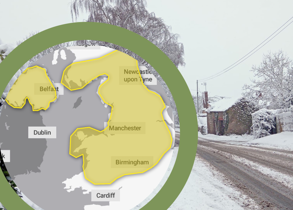
The Met Office has issued a further warning for Herefordshire, which is valid for this evening and early tomorrow. It is for ice and snow, with the snow most likely over hills.
The Met Office warning says:
“An area of low pressure will move across the UK through today and Friday with snow continuing across Wales and central England this morning.
“Snow is expected to move slowly north during the day, becoming slow-moving across north Wales, northern England, Northern Ireland and southern Scotland during the afternoon and evening before slowly clearing southeast on Friday.
“Snow will likely turn to sleet or rain at times at lower elevations, especially in the south of the warning area, as well as near eastern coasts. At low levels including major cities such as Manchester, Liverpool and Newcastle accumulations are expected to be limited with a small chance of 2-5 cm falling.
“However, significant snow accumulations are possible over hills of northern England (including populated areas of South and West Yorkshire), Northern Ireland and southern Scotland.
“Here, 10-15 cm is expected quite widely above 100 metres, with a chance that 25-40 cm could fall in some places. Additionally, there is potential for strong winds, which may lead to blizzard conditions and drifting of lying snow.”
The Met Office forecast for The Midlands overnight says:
Rain continuing into the evening, with some heavier bursts at times. Turning more wintry overnight, with snow mainly across higher ground. Staying fairly breezy overnight where it will feel particularly cold. Minimum temperature -1 °C.


