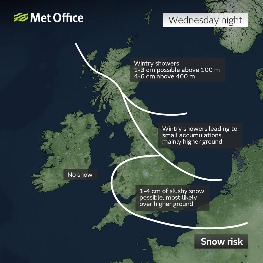
The Met Office has issued an update on the potential snow risk across parts of the United Kingdom over the next 24-48 hours.
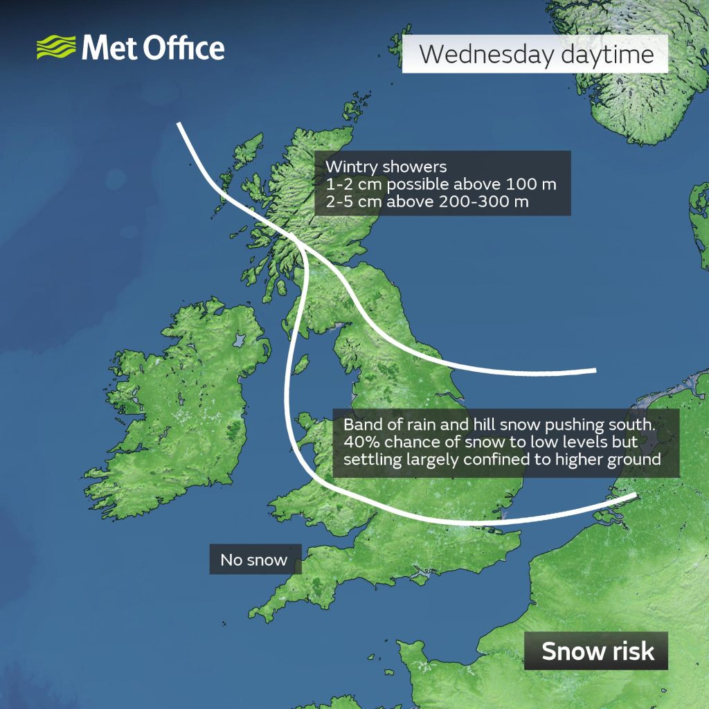
The main snow risk on Wednesday daytime is expected to be over higher ground. However on Wednesday evening and overnight, snow is possible at lower levels with a slushy covering of 1-4cms possible in some parts, mainly over higher ground.
The Met Office forecast for the West Midlands:
Wednesday:
A generally cloudy day with outbreaks of rain spreading south. The rain possibly mixing with sleet and snow over the hills later. Feeling much colder. Maximum temperature 9 °C.
Outlook for Thursday to Saturday:
Much colder than of late with overnight frosts and a mixture of sunny/clear spells and showers, these falling as a mixture of rain, sleet, hail and possibly snow at times.
More details – https://www.metoffice.gov.uk/weather/forecast/gcq04hx21#?date=2022-03-29