
The Environment Agency has issued a number of flood alerts on rivers in Herefordshire, with torrential rain falling on saturated ground.
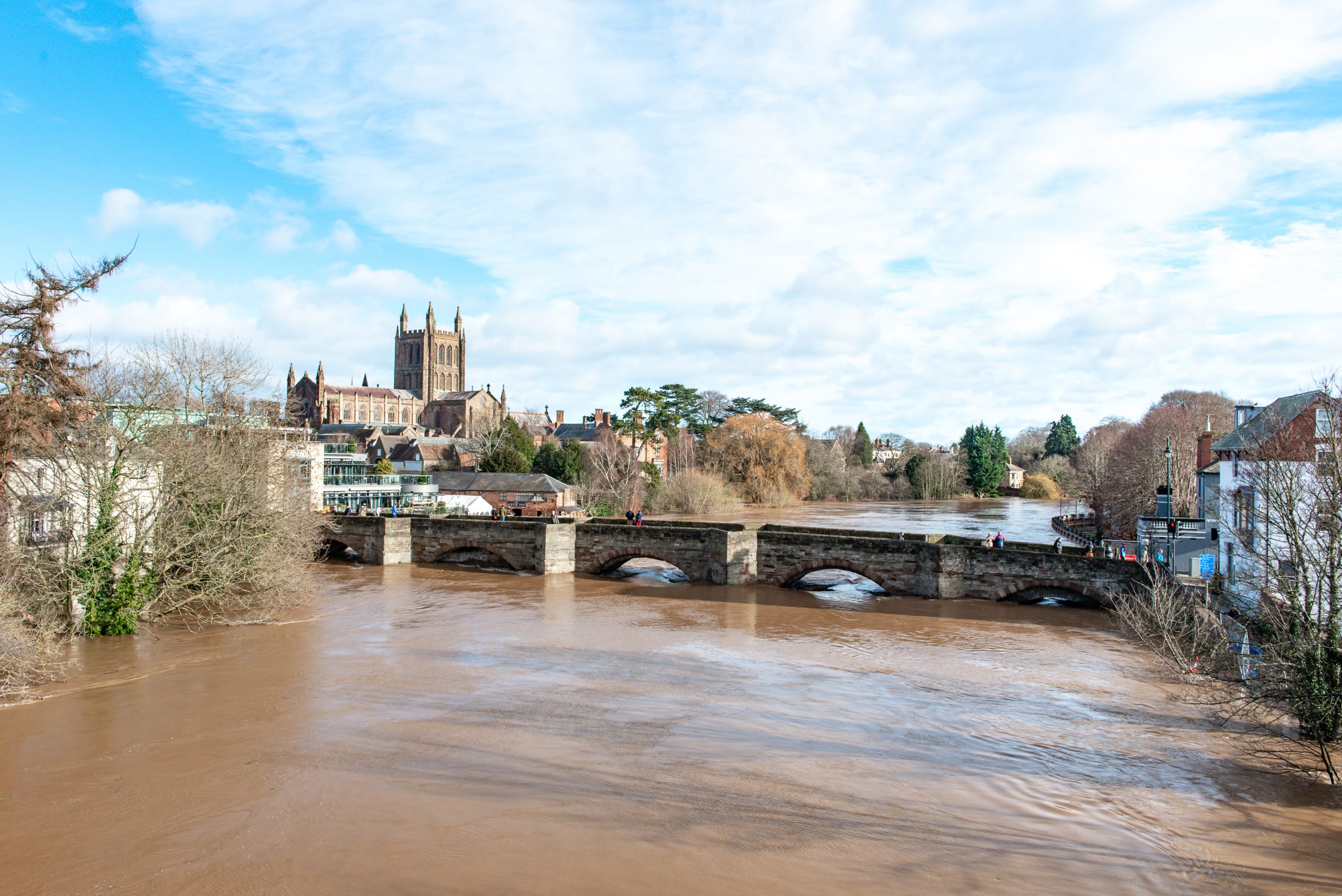
River Wye in Herefordshire
River levels are forecast to rise again at the Hay-On-Wye, Bredwardine, Belmont, Old Wye Bridge, Mordiford & Ross-On-Wye river gauges as a result of heavy rainfall forecast tonight. Consequently, flooding of roads & farmland is expected to begin again tomorrow, Saturday 30/1/21. We expect flooding to affect low lying land & roads along the River Wye from Hay on Wye to Ross on Wye. Locations that may be affected are the A438, Byford, Bredwardine & Hereford. Predicted peaks:- Hay on Wye 2.8m to 3.2m Saturday evening 30/1/21 & Bredwardine 5.3m to 5.7m Saturday night 30/1/21. Further rainfall is expected overnight,which will cause river levels to rise. We will provide forecast peaks once we have more confidence in rainfall totals & the impact this will have on river levels. We expect river levels to remain high over the weekend. We are monitoring the situation. Please avoid contact with flood water. This message will be updated by 10am on 30/1/21, or as the situation changes.
River Lugg south of Leominster
River levels remain high but steady at the Lugwardine river gauge following the recent heavy rainfall. Consequently, flooding of roads and farmland is expected to continue. We expect flooding to affect low lying land and roads adjacent to the River Lugg south of Leominster from Stoke Prior to Mordiford. Other locations that may be affected include Bodenham, Lugwardine and Hampton Bishop. Levels at the Butts Bridge and Ford Bridge gauges are now below their flood risk threshold. Further rain is forecast over the next 48 hours, which may cause river levels to rise again on Saturday. We are closely monitoring the situation. Please avoid using low lying footpaths and roads near local watercourses and avoid contact with flood water. This message will be updated by 10am on Saturday, 30/01/21, or as the situation changes.
River Leadon Catchment
River levels remain high but steady at the Wedderburn Bridge river gauge as a result of heavy rainfall. Consequently, flooding of roads and farmland continues. We expect flooding to affect low lying land and roads adjacent to the River Leadon. Locations that may be affected include Ledbury, Much Marcle, Staunton and Tibberton. Water is over the road at Upleadon Court. Wedderburn Bridge river gauge peaked at 2.52m on Thursday evening, 28/01/2021. Further rainfall is forecast over the next 48 hours which may keep river levels high. We are continuing to monitor the situation. Please avoid using low lying footpaths near local watercourses and plan driving routes to avoid low lying roads near rivers, which may be flooded. This message will be updated by 9am on Saturday, 30/01/21, or as the situation changes.


