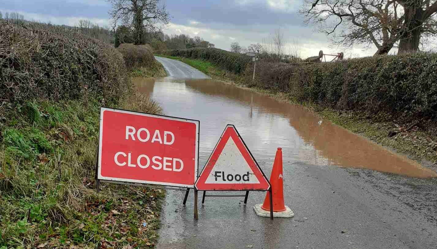
The Environment Agency has provided an update on the flooding situation in Herefordshire, with Storm Eunice hitting the county today.
RIVER WYE IN HEREFORDSHIRE (Last update – 5pm Thursday)
“River levels are rising at the Mordiford river gauge as a result of recent heavy rainfall. Consequently, flooding of roads and farmland is expected. We expect flooding to affect low lying land and roads along the River Wye from Hay on Wye to Ross on Wye. Other locations that may be affected include the A438, Byford, Bredwardine and Hereford. River levels have risen and are expected to stay high, falling slightly and rising again to at all gauge locations due to forecast storm Eunice. Peaks: Hay-on-Wye peaked at 2.64m last night; Bredwardine 4.65m early this morning; Belmont peaked at 4.7 at midday, Hereford peaked at 4.2m this afternoon, predicted peaks; Mordiford peaking at 4.3m this afternoon, Ross on Wye 3.6 to 4.1 this evening. We are closely monitoring the situation. Please avoid using low lying footpaths near local watercourses and plan driving routes to avoid low lying roads near rivers, which may be flooded. This message will be updated by 10am on Friday 18/02/22, or as the situation changes.”
UPPER TEME (Last update – 7am today)
“River levels have risen at the Leintwardine river gauge as a result of heavy rainfall. Consequently, flooding of roads and farmland is expected this morning, 18/02/22. We expect flooding to affect low lying land and roads adjacent the River Teme, River Onny and River Corve and their tributaries. Locations that may be affected include Bishops Castle, Church Stretton, Knighton and Ludlow. Predicted peaks:- Leintwardine 1.4m to 1.6m Friday afternoon 18/02; Onibury 1.8m to 2.0m Friday afternoon 18/02; Corve 2.2m to 2.6m Friday evening 18/02. Further rainfall is forecast over the next 24 hours. We expect river levels to remain high over the next few days. We are closely monitoring the situation. Our incident response staff are clearing weed screens. Please avoid using low lying footpaths near local watercourses and plan driving routes to avoid low lying roads near rivers, which may be flooded. This message will be updated by 18:00 on 18/02/22, or as the situation changes.”
RIVER LUGG SOUTH OF LEOMINSTER – (Last update – 5pm Thursday)
“River levels remain high at the Lugwardine river gauge, because of recent heavy rainfall. Consequently, flooding of roads and farmland is expected to continue. We expect flooding to affect Low lying land and roads adjacent to the River Lugg south of Leominster from Stoke Prior to Mordiford. Other locations that may be affected include Bodenham, Lugwardine and Hampton Bishop. Further rainfall is forecast over the next few days, with heavier rainfall predicted over the weekend. We expect river levels to remain high for several days. We are closely monitoring the situation. Please plan driving routes to avoid low lying roads near rivers, which may be flooded and avoid using low lying footpaths near local watercourses. This message will be updated by 10 am on Friday, 18/02/22 or as the situation changes.”
RIVER ARROW – (Last update – 5pm Thursday)
“River levels have fallen but forecast to rise again overnight at the Titley Mill river gauge. Consequently, flooding of roads and farmland is expected. We expect flooding to affect low lying land and roads along the River Arrow from Michaelchurch to Brierley. Other areas that may be affected include Kington, Staunton and Eardisland. No flooding is currently expected at other locations. Further rainfall is forecast over the next few days, with heavier rainfall predicted over the weekend. We are closely monitoring the situation. Please avoid using low lying footpaths near local watercourses and plan driving routes to avoid low lying roads near rivers, which may be flooded. This message will be updated by 10am on Friday, 18/02/22, or as the situation changes.”
SEVERE FLOOD WARNINGS ISSUED FOR WYE ESTUARY AND SEVERN ESTUARY
- Epney on the Severn Estuary Updated at 2:27pm on 17 February 2022
- Framilode and Priding on the Severn Estuary Updated at 2:27pm on 17 February 2022
- Frampton, Upper Framilode and Saul on the Severn Estuary Updated at 2:27pm on 17 February 2022
- River Severn at Hempsted Updated at 2:28pm on 17 February 2022
- River Severn at Minsterworth and Stonebench Updated at 2:28pm on 17 February 2022
- River Severn at Sandhurst and Maisemore Updated at 5:47pm on 17 February 2022
- Tidal Severn from Elmore to Rodley Updated at 2:27pm on 17 February 2022
- Westbury, Broadoak and Newnham on the Severn Estuary Updated at 2:31pm on 17 February 2022
- Wye Estuary at Brockweir Updated at 3:41pm on 17 February 2022
- Wye Estuary at Elmdale, Chepstow Updated at 3:41pm on 17 February 2022
Further Details – Flood alerts and warnings – GOV.UK (check-for-flooding.service.gov.uk)