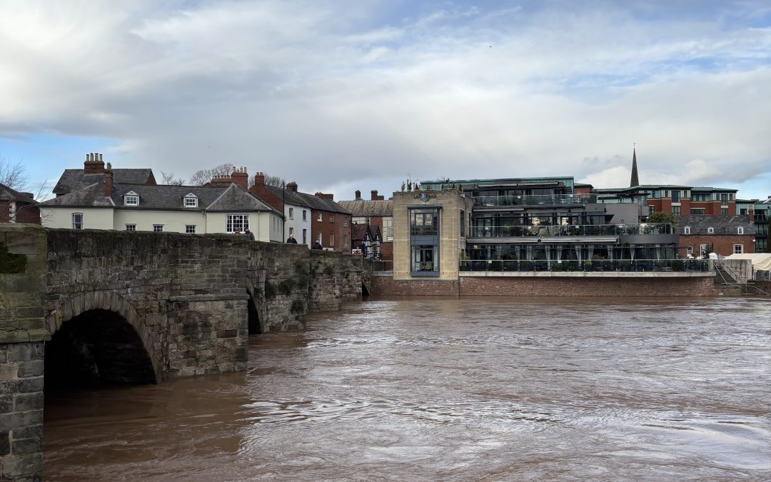
Heavy rain is causing difficult driving conditions on many routes in Herefordshire and South Wales this afternoon.
The Met Office has issued a weather warning for heavy rain across a large area of South and Mid Wales, with an amber warning also in force across some parts.
This is likely to cause rivers in South Wales and Herefordshire to rise over the coming hours, with some localised flooding possible in places.
River levels on the Wye and Lugg are expected to rise, with possible flooding on the Dulas Brook, River Frome, River Arrow and River Leadon. The Yazor Brook in Hereford is also likely to rise over the next few hours, with some flooding possible.
There are currently difficult driving conditions on many routes, including the A465 between Hereford and Abergavenny, where there is a lot of standing water in some places.
We’ve also received reports of standing water on the A438 between Hereford and Brecon and the A40 between Ross-on-Wye and Monmouth. Conditions are likely to remain difficult into this evening, before the rain eases overnight.
Latest Flood Alerts:
River Wye in Herefordshire
“River levels are rising at the Ross-On-Wye river gauge as a result of heavy rainfall.
“Consequently, flooding of roads and farmland is expected overnight Sunday, the 23/02/25.
“We expect flooding to affect low lying land and roads along the River Wye from Hay on Wye to Ross on Wye.
“Locations that may be affected include the A438, Byford, Bredwardine and Hereford. Wilton lane may be flooded up to the junction with Fishermans Reach, Ross. Predicted peaks:- Hay on Wye 2.2m to 2.4m on 24/02, Bredwardine 4m to 4.3m on 24/02, Belmont 4m to 4.3m at on 24/02, Old Wye Bridge 3.6m to 3.9m on 24/02, Mordiford 3.9m to 4.2m on 24/02, Ross on Wye 3.5m to 3.8m on 25/02.
“We expect river levels to remain high for the next few days.
“We are closely monitoring the situation. Our incident response staff are checking defences.
“Please avoid using low lying footpaths near local watercourses.
“This message will be updated by 10:00 on 24/02/25, or as the situation changes.”
River Lugg – south of Leominster
“River levels are rising at the Lugwardine river gauge as a result of heavy rainfall.
“Consequently, flooding of roads and farmland is expected between overnight Sunday into early Monday morning, the 24/02/25.
“We expect flooding to affect Low lying land and roads adjacent to the River Lugg south of Leominster from Stoke Prior to Mordiford. Other locations that may be affected include Bodenham, Lugwardine and Hampton Bishop.
“We expect river levels to remain high for the next few days.
“We are closely monitoring the situation. Our incident response staff are checking defences.
“Please avoid using low lying footpaths near local watercourses and plan driving routes to avoid low lying roads near rivers, which may be flooded.”
River Arrow in Herefordshire
“River levels are rising at the Titley Mill river gauge as a result of heavy rainfall.
“Consequently, flooding of property, roads and farmland is expected overnight Sunday, the 23/02/25. We expect flooding to affect low lying land and roads along the River Arrow from Michaelchurch to Brierley. Other areas that may be affected include Kington, Staunton and Eardisland.
“We expect river levels to remain high until Tuesday the 24/02/25.
“We are closely monitoring the situation. Our incident response staff are checking defences.
“Please avoid using low lying footpaths near local watercourses and plan driving routes to avoid low lying roads near rivers, which may be flooded.”
For more information on Flood Warnings, please visit – https://check-for-flooding.service.gov.uk/alerts-and-warnings
The Met Office warning for rain across South and Mid Wales:
“Rain will become persistent and heavy through Sunday, clearing to the east overnight but followed by showers into Monday morning.
“Accumulations of 20-40 mm are expected widely, with the heaviest rain over high ground, especially over south or southwest-facing hills.
“As much as 80-100 mm may fall in the most exposed areas, covered by a separate Amber warning.
“Rain will also be accompanied by strong south to southwesterly winds, making for poor travel conditions.”
More details – https://weather.metoffice.gov.uk/warnings-and-advice/uk-warnings#?date=2025-02-23
The Amber Warning for South Wales:
“Rain will become persistent and heavy through the remainder of Sunday, clearing to the east overnight but followed by showers into Monday morning.
“Accumulations of 50-70 mm are expected fairly widely over high ground well-inland, with the most exposed hills potentially receiving 80-100 mm.
“This may lead to some surface water and river flooding.
“In addition, strong south to southwesterly winds will also accompany the rain.”
More details – https://weather.metoffice.gov.uk/warnings-and-advice/uk-warnings#?date=2025-02-23


