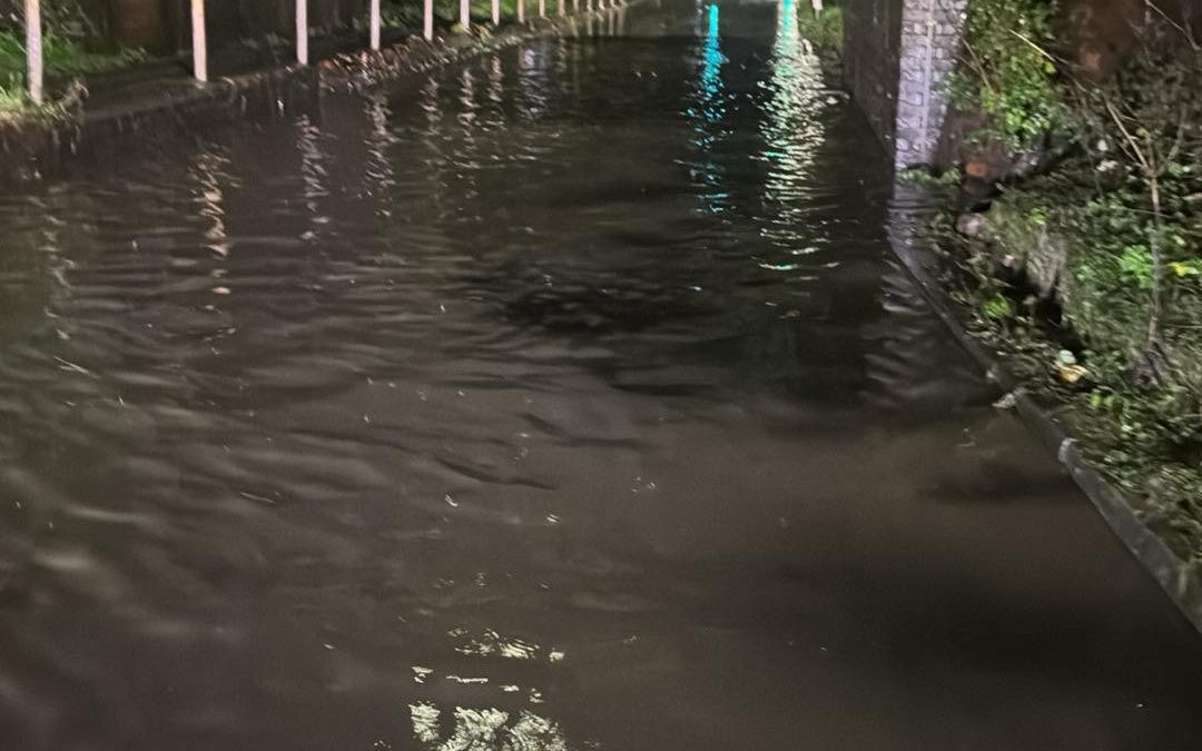
Heavy rain overnight is causing disruption in parts of Herefordshire this evening.
The B4216 From C1310 To A417 Ledbury Bypass is closed due to flooding.
There is significant standing water on Holme Lacy Road in Hereford, under the railway bridge, however this is now passable.
Flooding is affecting Three Elms Road between the junction for Grandstand Road and Whitecross School.
There are also reports of significant standing water on many routes in the Ledbury area.
Several flood alerts have been issued on rivers in Herefordshire, with further rain on the way this evening.
A Met Office Warning that is in place for Herefordshire says:
“Whilst some areas will miss the worst, heavy showers and some thunderstorms will occur during today, potentially becoming more organised across a swathe of Wales and into central and eastern England during Thursday evening and on into early Friday morning.
“10-15 mm of rain could occur within an hour from the heavy showers during today with a few places possibly seeing 30 mm over a few hours.
“There still remains some uncertainty in the details for Thursday evening and overnight, but some locations may see up 20-30 mm of rain in 2-3 hours and perhaps 40-60 mm in 3-6 hours.
“Given the recent very wet weather, this will bring the potential for further flooding and transport disruption.”
Warning link – https://www.metoffice.gov.uk/weather/warnings-and-advice/uk-warnings#?id=42d36d6d-f276-4ec0-ab42-9f802f30798e&date=2024-09-26
Current Flood Alerts:
River Arrow in Herefordshire
“River levels are rising at the Titley Mill river gauge as a result of heavy rainfall. Consequently, flooding of roads and farmland is possible this evening, 26/09/24.
“We expect flooding to affect low lying land and roads along the River Arrow from Michaelchurch to Brierley. Other areas that may be affected include Kington, Staunton and Eardisland.
“Further rainfall is forecast over the next 24 hours.
“We are closely monitoring the situation.
Please avoid using low lying footpaths near local watercourses and plan driving routes to avoid low lying roads near rivers, which may be flooded.”
River Frome in Herefordshire
“River levels are rising at the Bromyard river gauge as a result of heavy rainfall. Consequently, flooding of roads and farmland is expected this evening, 26/09/24.
“We expect flooding to affect low lying land and roads along the River Frome from Bromyard to Hereford.
“Other locations that may be affected include Bishops Frome and Yarkhill.
“Further rainfall is forecast over the next 24 hours.
“We are closely monitoring the situation.
“Please avoid using low lying footpaths near local watercourses and plan driving routes to avoid low lying roads near rivers, which may be flooded.”
River Leadon Catchment:
“River levels are forecast to rise at the Wedderburn Bridge river gauge because of recent rainfall and further rainfall tonight, 26/09/24.
“Consequently, the risk of flooding remains. We expect flooding to affect low lying land and roads adjacent to the River Leadon.
“Locations that may be affected include Ledbury, Much Marcle, Staunton and Tibberton.
“Water may be out of bank at Upleadon Court.
“Further rainfall is forecast over the next 24 hours. We expect river levels to rise until early afternoon on Friday 27/09/24.
“We are closely monitoring the situation.
“Please avoid using low lying footpaths near local watercourses and plan driving routes to avoid low lying roads near rivers, which may be flooded.”
River Lugg South of Leominster
“River levels are rising at the Lugwardine river gauge as a result of heavy rainfall.
“Consequently, flooding of roads and farmland is possible overnight tonight, 26/09/24. We expect flooding to affect Low lying land and roads adjacent to the River Lugg south of Leominster from Stoke Prior to Mordiford.
“Other locations that may be affected include Bodenham, Lugwardine and Hampton Bishop.
“Further rainfall is forecast over the next 24 hours.
“We are closely monitoring the situation.
“Please avoid using low lying footpaths near local watercourses and plan driving routes to avoid low lying roads near rivers, which may be flooded.”

