Further localised flooding is possible across parts of Herefordshire today, with a Met Office warning in force across northern parts of the county.
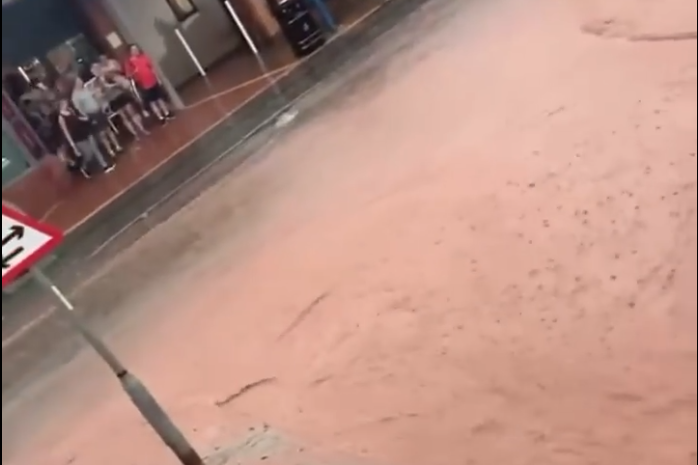
Residents in parts of Herefordshire that were hit by torrential rain and flash flooding yesterday will be hoping to miss the worst of things today. Videos and photos from Bromyard showed torrents of muddy water flowing through the town centre following a 15 minute torrential downpour yesterday evening.
From Met Office:
Heavy showers and thunderstorms are expected to develop during Tuesday across much of Wales, northern and central England. These will last well into the night across north Wales and north-west England in particular where they could be prolonged in places. 20 to 30 mm of rain is possible in around 1 or 2 hours, and a few places could see around 60 mm in 3 to 6 hours . Lightning and hail may pose additional hazards in a few locations.